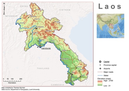
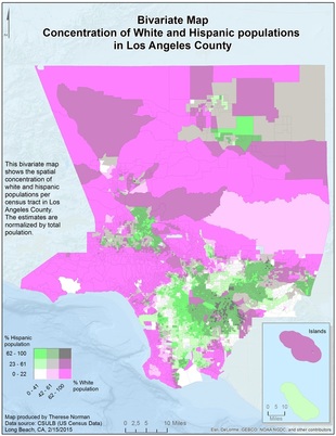
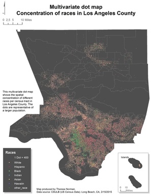
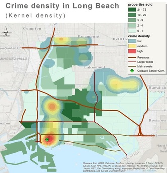
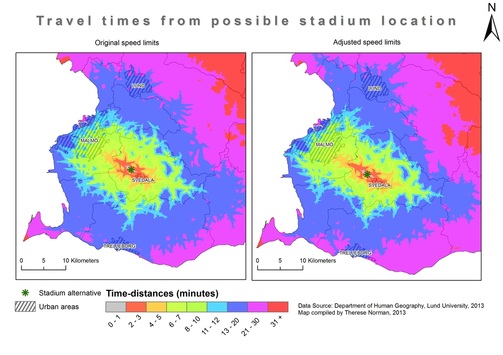
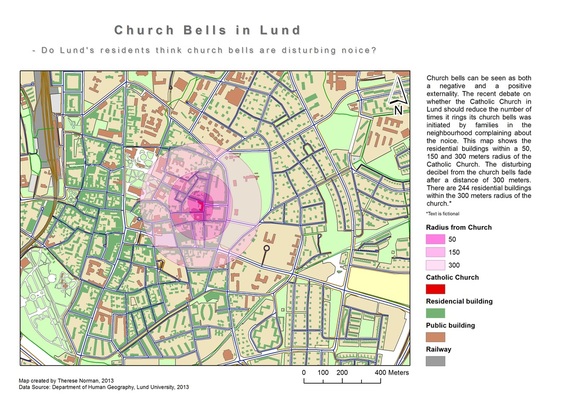
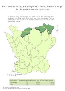
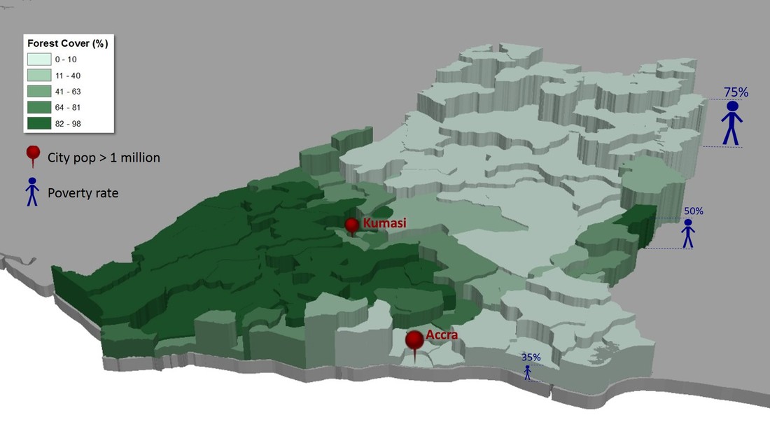
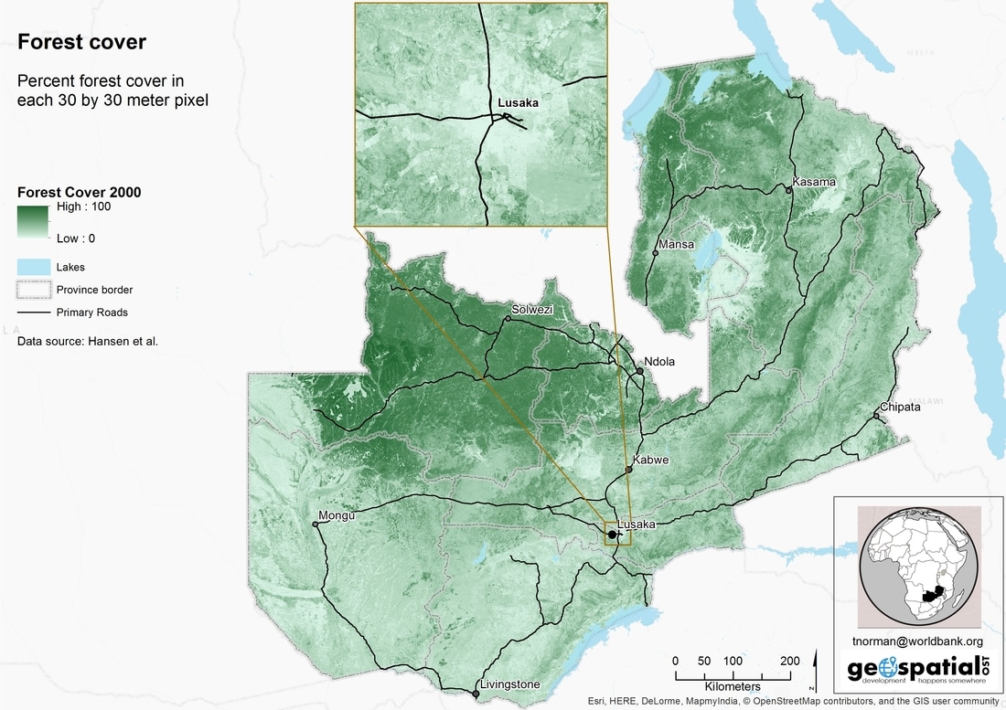
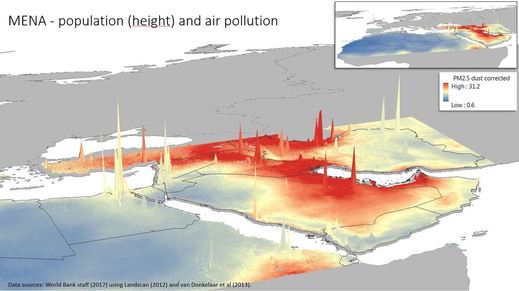
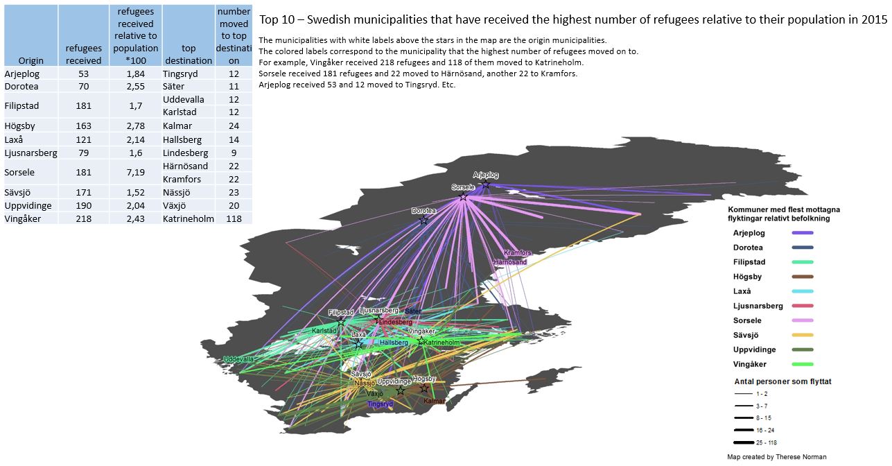
Cartography - maps, maps, and more maps by me
|
|
|
|
|
|


|
|
|
|
|
|
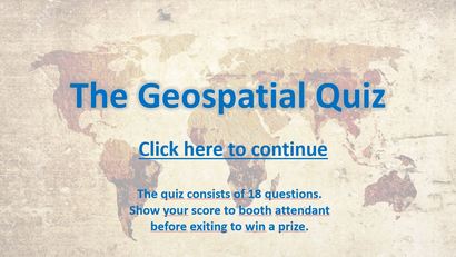
The Geospatial Quiz was made as a fun and interactive way to introduce "geospatial" ideas to colleagues at work during Geospatial Day. It's only for fun and may contain errors.
OBS! The file is a macro enabled PowerPoint. Double-clicking to open it may not work properly. In order to upon it up with the macro-enabled functionality, right-click and choose 'New'. Then go to slide-show view to play the quiz. You may get a warning message where you have to accept the macro-enabled functionality. The maximum score is 18. The highest score during the day was 15 (by a geospatial professional).
OBS! The file is a macro enabled PowerPoint. Double-clicking to open it may not work properly. In order to upon it up with the macro-enabled functionality, right-click and choose 'New'. Then go to slide-show view to play the quiz. You may get a warning message where you have to accept the macro-enabled functionality. The maximum score is 18. The highest score during the day was 15 (by a geospatial professional).
